As global tensions often dominate international headlines, many Americans have begun asking a challenging question: if a large-scale conflict ever escalated into a global crisis, which parts of the United States might face greater risk? Although there is no confirmed worldwide war taking place, defense analysts and researchers regularly examine theoretical scenarios to understand how geography, infrastructure, and strategic assets could influence outcomes during extreme events.
These exercises are not forecasts. They exist primarily as preparedness tools used by military planners, policy specialists, and emergency management experts. By modeling different possibilities, analysts aim to understand vulnerabilities and improve response planning in the event of an unexpected crisis.
One of the most frequently discussed factors in these simulations involves the placement of strategic military infrastructure. The United States maintains intercontinental ballistic missile systems as part of its nuclear deterrent strategy. Many of these missile silos are located in central regions of the country, where geography allows for dispersed installations and operational security.
Because of this infrastructure, certain states often appear in theoretical analyses examining potential strategic targets. States such as Montana, Wyoming, Colorado, Nebraska, North Dakota, South Dakota, Iowa, and Minnesota are commonly referenced in defense research due to their proximity to missile fields or related facilities.
The inclusion of these locations in academic discussions does not reflect current events or imminent threats. Instead, it reflects the role those areas play within the broader national defense structure.
In hypothetical nuclear exchange scenarios, analysts often examine how targeting decisions could be influenced by the presence of military installations. Strategic doctrine historically emphasizes the importance of neutralizing an opponent’s ability to launch a counterattack. This means infrastructure connected to missile systems, command centers, and military bases may appear in strategic models.
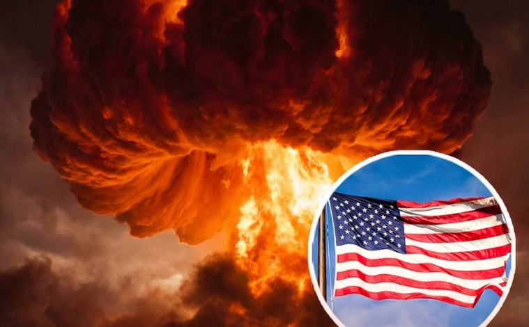
However, experts consistently emphasize an important point: the consequences of nuclear conflict would extend far beyond any initial targets.
Radiation fallout patterns depend on many unpredictable variables. Wind direction, atmospheric conditions, weather systems, and terrain all influence how radioactive particles travel after an explosion. A detonation in one region could spread contamination across large areas depending on environmental conditions.
Infrastructure disruption would also have nationwide consequences. Transportation networks, energy systems, communication lines, and supply chains are interconnected across the country. Damage to key facilities in one location could affect communities hundreds or even thousands of miles away.
Food production and water safety would become major concerns as well. Agricultural regions might experience contamination, and disruptions in distribution networks could affect grocery supplies in distant states.
Economic instability would likely follow such a crisis. Financial markets, employment patterns, and manufacturing systems depend on complex national and global relationships. A large-scale conflict would influence these systems far beyond any specific geographic location.
For this reason, defense experts often explain that there is no completely safe region in a nuclear conflict scenario. Instead, analysts speak in terms of varying levels of strategic significance rather than absolute safety.
In theoretical modeling exercises, states with fewer major military installations sometimes appear as lower direct-target risk areas. Portions of the Northeast and Southeast are occasionally categorized this way because they host fewer missile fields compared to central states.
Regions that appear in these discussions include Maine, New Hampshire, Vermont, Massachusetts, Rhode Island, Connecticut, New York, New Jersey, Pennsylvania, Delaware, Maryland, Virginia, West Virginia, North Carolina, South Carolina, Georgia, Florida, Alabama, Mississippi, Tennessee, Kentucky, Ohio, Indiana, and Michigan.
Even in these models, analysts emphasize that risk levels remain relative rather than definitive. Fallout patterns, infrastructure disruptions, and secondary effects could still influence large areas far from original targets.
Preparedness research focuses less on predicting disasters and more on improving resilience. Emergency planning agencies study evacuation systems, medical response capabilities, food distribution networks, and communication strategies in order to strengthen national readiness.
Public awareness also plays a role in resilience planning. Understanding how infrastructure functions, how emergency alerts operate, and how communities respond to crises can improve outcomes during difficult situations.
The purpose of these discussions is not to create fear. Instead, they highlight how governments and researchers analyze potential risks so that preparedness systems remain strong.
In an uncertain world, resilience depends on planning, cooperation, and informed decision-making. By studying theoretical scenarios today, experts aim to strengthen the systems that protect communities tomorrow.